Colonized Map Of Africa
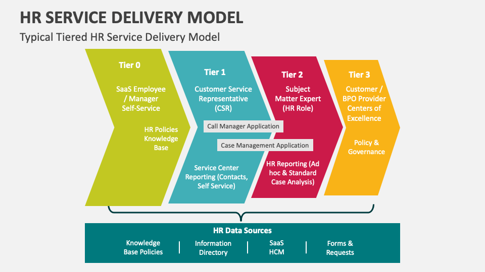
What is a service delivery model. What is a service delivery model
A colonized map of Africa is not a neutral picture of geography; it is a record of extraction, administrative violence, and the forced stitching together of peoples, languages, trade routes, and lifeways into colonial possessions. In Black and African-centred terms, such a map reminds us that the continent’s borders were drawn not to protect African communities but to maximise imperial profit, pacify rival European powers, and make land, labour, and resources legible to distant capitals. Yet it also points toward another story: the story of Black African resistance, adaptation, and renewal. Every colonial line attempted to fix African people in place, to categorise them through race, tribe, and territory, and to make their futures subservient to foreign control. Despite this, African societies preserved memory, created new forms of solidarity, and kept demanding sovereignty long after the flags of empire came down.
How the Colonized Map of Africa Shaped Borders and Belonging
At the Berlin Conference of 1884–1885, European powers formalised a “scramble” that treated African territory like a negotiable asset. The resulting map divided the Congo basin between Belgium and France, assigned coastal enclaves to Britain, Portugal, Spain, and Italy, and gave Germany an initial foothold in east and south-west Africa. In practice, this meant that communities who had once moved across shared river systems, pastures, or caravan routes suddenly found themselves subject to different passports, tariffs, courts, and police regimes. Colonial administrators often relied on indirect rule, selecting favoured chiefs or inventing “native authorities” to make occupation seem orderly. That administrative logic still influences service delivery, land tenure, and citizenship debates across the continent. A colonized map of Africa must therefore be read as a political document. It shows how imperial powers attempted to turn fluid geographies into fixed territories, and how race became the organising principle of governance. Yet it also reveals the limits of colonial control. African workers migrated across borders, traders maintained kinship networks, farmers and fishers moved with the seasons, and intellectuals built pan-African institutions that refused narrow territorial nationalism. The map tried to make empire permanent, but it could not contain African mobility, language, or imagination. Today, the borders inherited from colonialism remain major sources of tension: citizenship disputes, cross-boundary ethnic groups, resource conflicts, and uneven development. A decolonial reading does not call for drawing new lines through violence. Instead, it asks us to recognise how colonial maps created hierarchies that still shape politics, economics, and belonging. African agency matters because the continent’s history is not only one of being drawn upon, but of drawing, negotiating, resisting, and reimagining community beyond empire. The map remains important as a warning: when borders serve extraction more than human flourishing, the effects echo through generations. Yet Africa’s future must not be reduced to a colonial legacy. It must be rooted in justice, regional cooperation, and a clear-eyed understanding of how the old map still shapes lives.