World War 2 Map
World War II maps of Asia tell a story that no single battle report ever could. Between 1937 and 1945, the vastness of the Pacific and the Indian Ocean turned geography itself into a weapon. Armies that could march across Europe in weeks needed months to cross the Pacific, and navies measured their reach not in kilometres but in fuel, carriers and island airfields. Reading a wartime map of Asia is therefore an exercise in understanding distance: the arcs of Japanese expansion, the choke points of the Malay Peninsula and the Strait of Malacca, the long supply lines running from Hawai'i to Australia, and the island chains that served as stepping stones. For anyone studying the conflict today, these maps reveal why campaigns unfolded where they did, why certain ports mattered more than entire provinces, and why the post-war settlement in Asia looked so different from the one drawn up for Europe.
From Wartime Maps to the Modern Basing Map of Asia
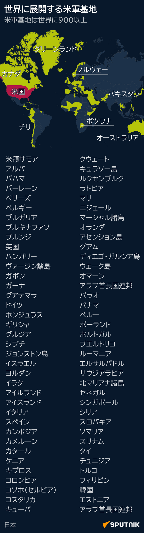
The geography that decided the Pacific War did not vanish in 1945. Many of the same anchorages, airstrips and islands that Japanese planners seized in 1941 and 1942 were later occupied, rebuilt and retained by the United States and its allies — Okinawa, Guam, the Philippines, Japan itself, and the chain running through the western Pacific. A map of military installations across the world shows this inheritance clearly: the heaviest concentrations sit exactly where the great carrier battles and amphibious landings once took place. To read a World War II map of Asia alongside a modern one is to see continuity rather than rupture. The distances are unchanged, the deep-water harbours are unchanged, and the logic of projecting power across the Pacific remains stubbornly the same. That is why the war still shapes diplomacy in the region, from the defence of Taiwan and the South China Sea to the alliances binding Australia, Japan, the Republic of Korea and the Philippines. History teachers often note that students grasp the Pacific campaign far faster when they trace it on a map rather than memorising dates. The lesson holds for anyone: borders may be redrawn, governments may fall, but the map underneath keeps its own counsel, quietly deciding which strategies are possible and which are merely ambitious. Understanding that inheritance makes the conflict of 1937 to 1945 legible, and it explains why its consequences are still being negotiated across Asia today.